Cartographers like Nicolaes Witsen made navigation to the colonies possible.
Not only was getting to the colonies a challenge, the newly acquired land also had to be mapped. The VOC hired its own cartographers, like Joan Blaeu and his father Willem Blaeu. Mapping the newly discovered America's sparked even more curiosity about what other continents we had not discovered yet (Australia), or what hidden shortcuts there could be to the East Indies (none unfortunately)
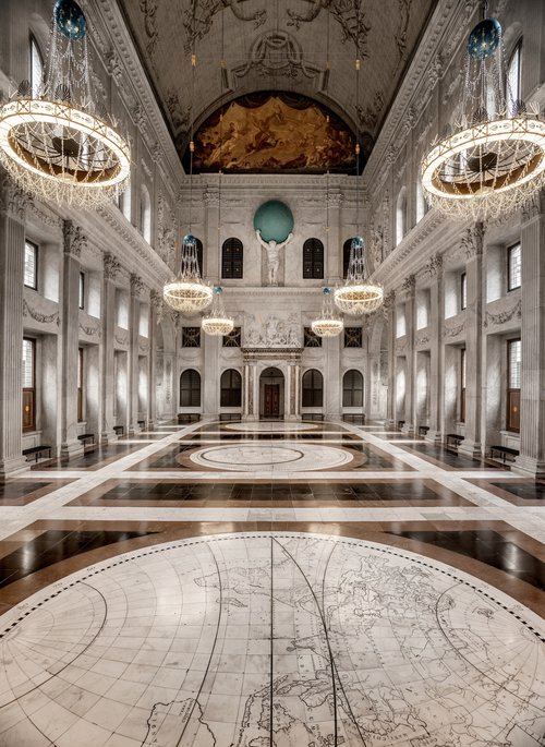
The Dutch were quite good at mapping, and were proud to show that off. In the Dam Palace we proudly presented huge world maps on the floor of the main hall, inlaid in the marble. According to the designers, this was made so the visitor would feel like they were in the very center of the world.
Source: paleisamsterdam.nl | Main hall of the Dam Palace (not sure if free to use)

Source | Map of the America's by Willem Blaeu (image free to use)